Table of Contents
Patchen California
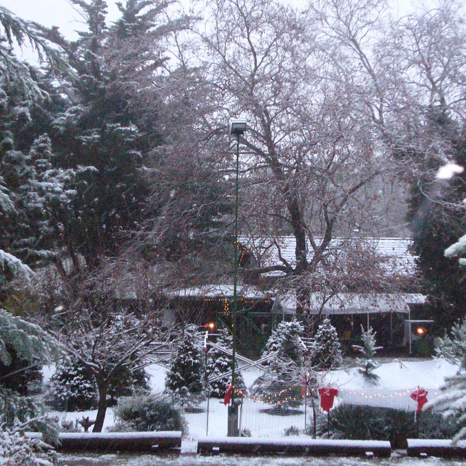
Patchen, California is one of five “Ghost Towns of the Santa Cruz Mountains” ((Currently out of print but try; https://www.amazon.com/Ghost-Towns-Santa-Cruz-Mountains/dp/0944220126)) which grew and flourished during the last half of the nineteenth century. are buried under tons of silt and millions of gallons of water in the Lexington Reservoir. The other two ( and ) are mostly forgotten and only accessible to the ardent explorer. Patchen was a vibrant center of activity and local culture for over a century. During the 1940’s the town was bypassed and isolated by the construction of Highway 17 but since the late 1960’s it has come alive again as a Christmas Tree ranch, preserving much of the charm and character of its nineteenth century heritage.
Patchen was once a thriving community; you need only to close your eyes and draw a deep breath of clean mountain air to recall it.
Ancient History
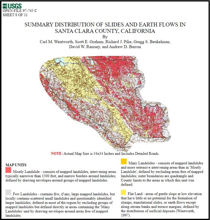
 It is hard to find an area in the Santa Cruz Mountains that has not been affected by a landslide sometime in the past. One such “Lobe” ((“Lobes” are bulges in the ground surface where the landslide mass mounds up at the toe of the landslide. With time, tension gashes fill with soil, the scarp erodes back, and vegetation covers the surface muting the features of the landslide. (USGS) )) created by an ancient slide characterizes the roughly one square mile around Patchen.
Click on the image to the left for Santa Clara County slides or to the right for the Patchen Lobe.
The Early Days
The first written record of this area was left by Spanish explorers in the mid-1700’s. According to one padre in Santa Cruz; “The adjacent mountains were wild and rugged, the canyons deep and dark with the shadows of the forest. Coyotes broke the stillness with their dismal howls and herds of deer slacked their thirst in the clear waters of the San Lorenzo. Grizzly bears were numerous, prowling about in herds like hogs on a farm.”((A Howling Wilderness, Payne, 1978))
This 1876 map from the David Rumsey Map Center at Stanford University includes a plat of Los Gatos, and another of Lexington, plus the name Patchen in the lower right corner, indicating that there were a number of buildings here at that time.

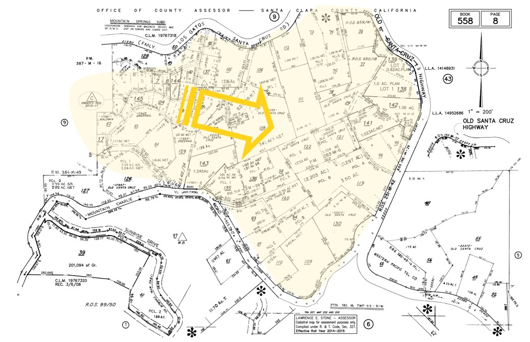
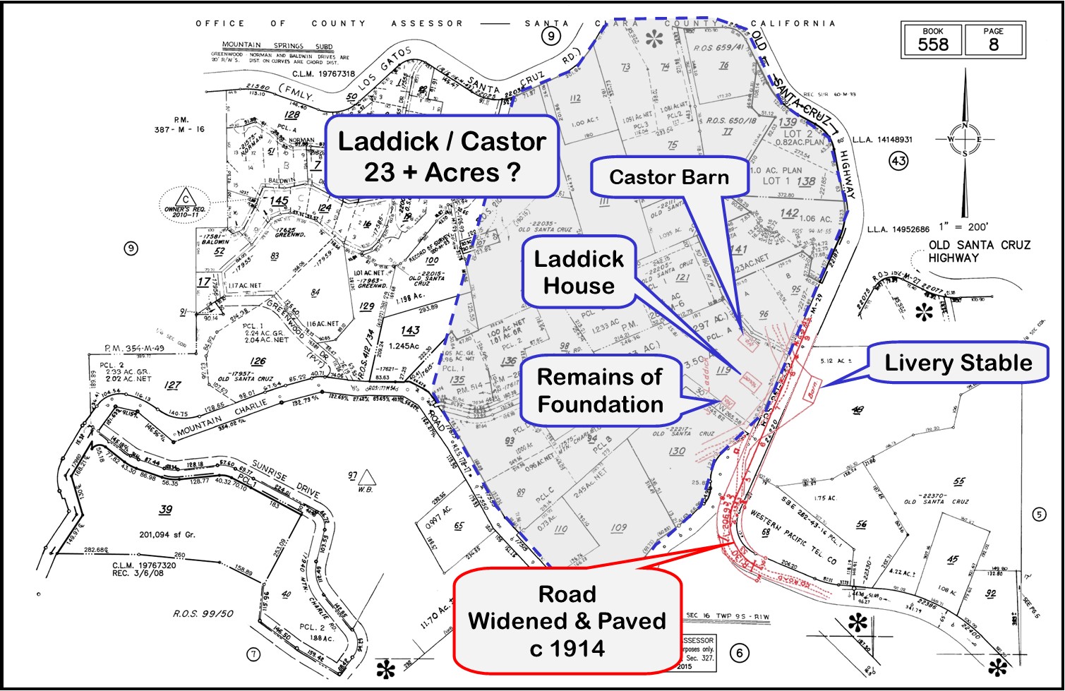 In the early part of the 20th Century the surrounding acreage was owned by the Laddicks and then by the Castors. The details of their holdings require further investigation but it is clear from the red overlay of a Santa Clara County Engineering Report in this image that at least four buildings existed here at the time the “County Road” was paved around 1914.
We know from the actual personal account of Alquist Norman Fenn that he stayed here at the age of 11 years, with “The Widow Laddick”, in a small house attached to the main “Laddick House”. Fenn visited us in 2014 at the age of 102, and reminisced about his experience in that house in 1923, while he finished the school year in the school house a half mile south of here.
 We also know that Claude Castor lived in the same house until he died on November 23, 1969, a few months after we bought the property adjoining it on the south. That house currently serves as a work shop on the Christmas Tree ranch.
This 1970s photo, taken by the current owner, shows “Grandpa Castor’s Chicken Coop”, as a current neighbor refers to it, in the upper right corner. The neighbor, who lived across the road in the 1940s remembers that “Grandpa Castor” could often be found there during times of domestic unrest at home.
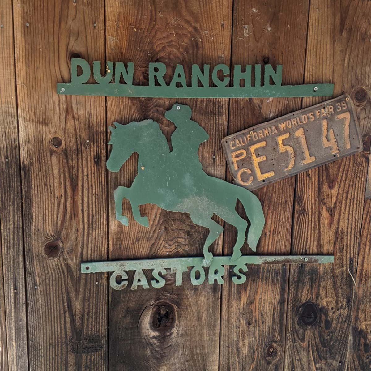
We bought the property with the “Castor Barn” and the remaining foundation of the “Laddick House” in 1973 from Claude’s daughter, Thelma Vanderpool, for $30,500.
“Mountain Charley”
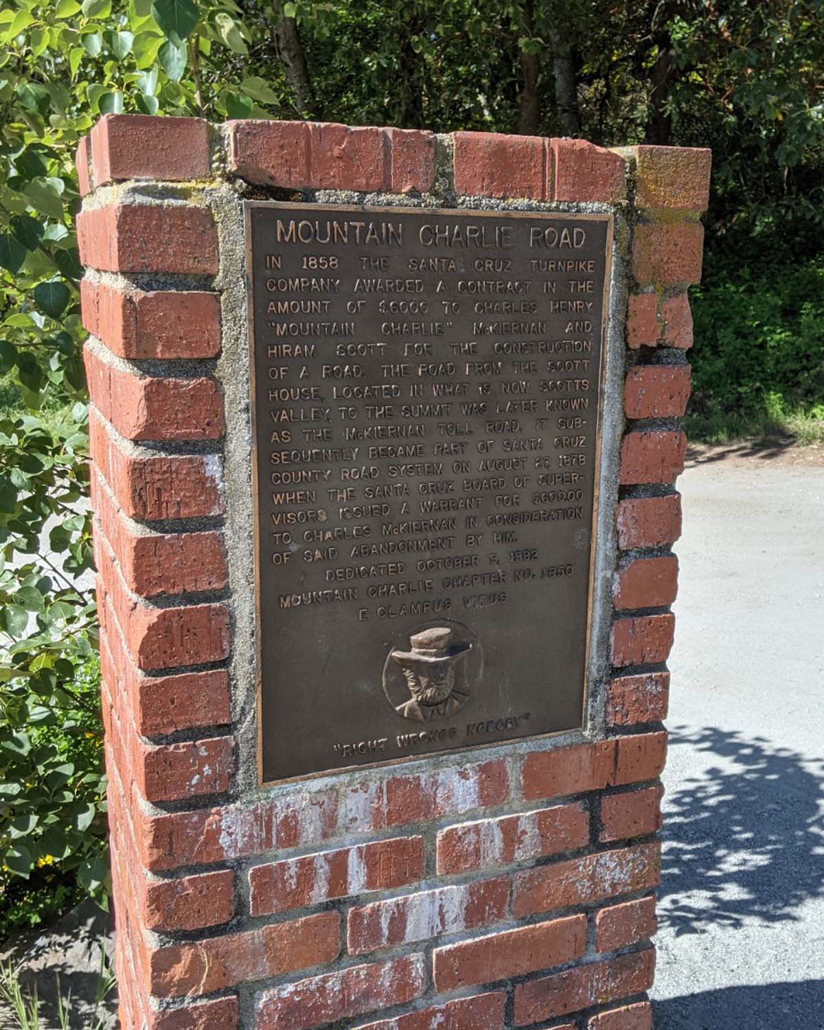
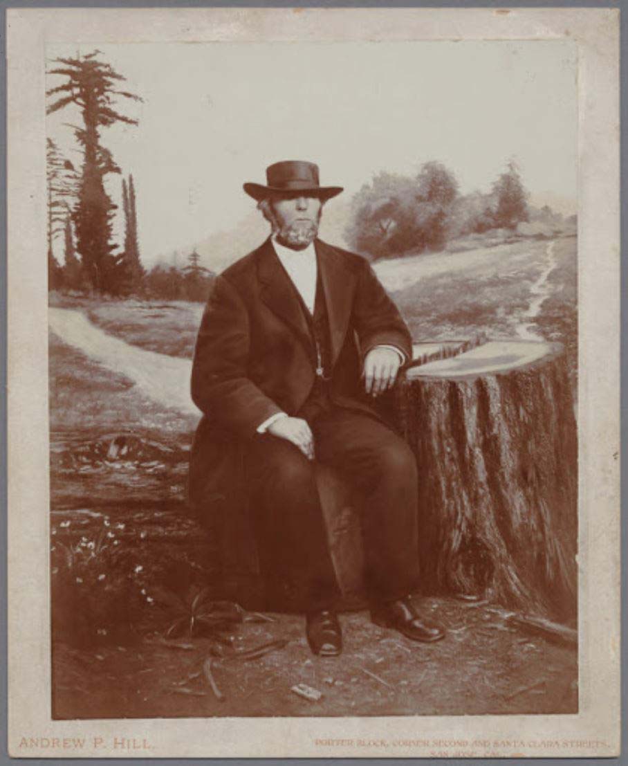 The United States took possession of California in 1846 and among the pioneers of the 1850’s came the earliest known permanent white settler; Charles Henry “Mountain Charley” McKiernan. In the 1850’s and 1860s McKiernan built roads throughout his property on the summit and operated a toll road down an old Indian trail near here. You might have driven down Mountain Charley Road to get to Patchen today.
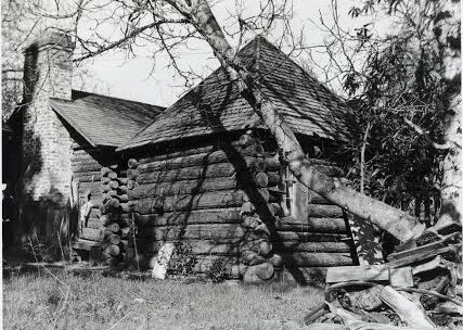 McKiernan settled near the lagoon about one mile south of here in 1850. At least portions of his cabin remains to this day.
Much lore exists about Charley, particularly about what happened to him about five miles southwest of here on May 8, 1854. Some are most likely based in fact – others maybe not so much.
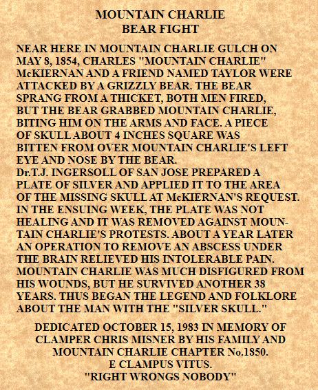
 One account can be seen on a monument erected by the Clampers a short distance off Hwy 17 to the west on Summit Road.
From the time of the accident until the end of his life he wore large brimmed hats, pulled down to his eyebrows, to hide the scars.
The last reported sighting of a Grizzly in the Santa Cruz Mountains was in November 1885 near Bonny Doon, but McKiernan lived until January 16, 1892.
State Registered Landmark #448
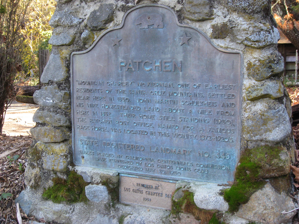
Directly across the road from the Christmas tree farm is California Historical Site marker #448, commemorating the town of Patchen and the legend of Mountain Charley. This was the first settlement in the Summit area and it was centered around the first Post Office in the area, called Patchen.
Visitors from around California and around the World often stop to read about Mountain Charley and Patchen. History enthusiasts are always welcome to walk though the Christmas trees and relive the days gone by.
The Patchen Name
In 300 B.C. there were people living in the area which is now known as Patching Parish in Sussex, England. People by the name Patching(en)(in) have been listed in that area since the 800’s A.D.. In 1634 Joseph Patching came to the U.S. and most of the Patchens in America can be traced to him.
The name reached this area by way of a famous race horse named “George M. Patchen” and his son, “Smith Patchen” nicknamed “California Patchen” because of his good showing in California in 1862 and again in 1867 in San Jose, San Francisco and Sacramento.
The Post Office
There are conflicting stories about the origin of the name for the Post Office and also its exact location from 1872 to 1876. Some accounts say it was first situated at the Fowler ranch, others indicate that it was in the house of a man named Shirley. The actual Post Office name appears on the government record as having been established at Patchen on March 28, 1872 where it operated until November 30, 1929 with a brief interruption in service between November 26, 1895 and April 29, 1897.
One of the first Post Masters was D.C. Feely. In 1885 he represented Patchen at the American Exposition at New Orleans. Feely took a polished wood collection, a soil sample from his farm, and a large exhibit of fresh fruit provided by the local fruit growers.
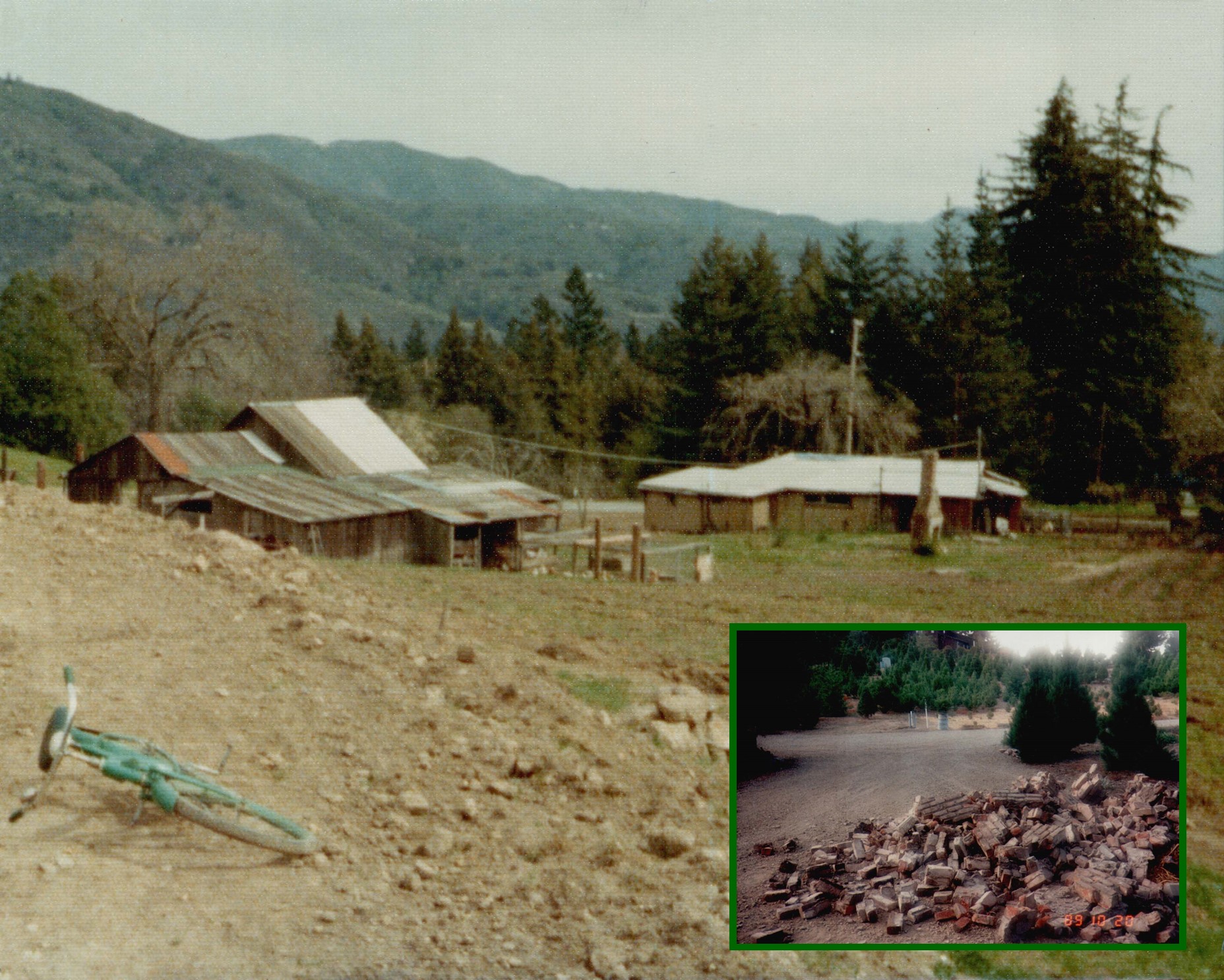
Click on the picture for a close-up of the “Castor Barn” in the left-center and the smaller of the two “Laddick Houses” near the center of the frame behind the chimney of the Post Office – still standing in this 1973 photo. The main “Laddick House” had burned 15 years prior. The inset shows the remains of the chimney after the 1989 earthquake and that fell that day.((Many of them, original San Jose Sand Molds))
“Call of the Wild”
The Feely Ranch, located about a quarter mile north of here, was a favored vacation spot of Jack London (1876 : 1916). It is often said that he wrote some of his best works while vacationing here. Incidentally London was also Secretary and Treasurer of the Communist Party of California during that same time period.
The area is still identified on the official Santa Clara County Assessor’s map as “Call of the Wild” and you will notice a road by the same name as you drive north from here.
The Edgemont Hotel
The was located in Patchen and operated by Mr. and Mrs. L.N. Scott ((I was advised later that this might not be the proper honorific for the couple)). Some say it was located in the flat area near the road, about where our farm’s main parking lot is today. Other reports suggest it was actually 400 yards south from here on what was then called “The County Road” or “Soquel Road” (Old Santa Cruz Hwy).
Stage Coach Stop
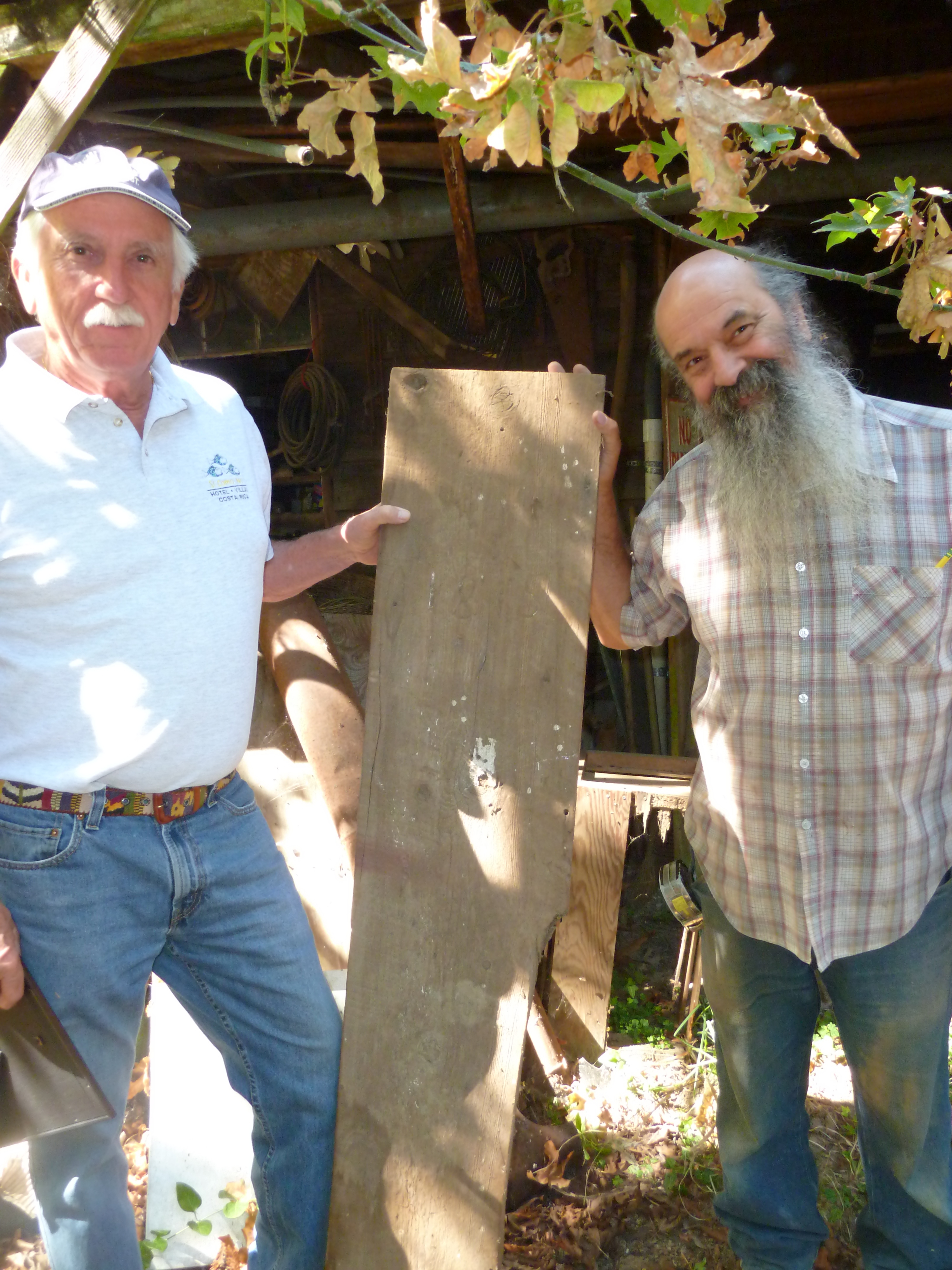 In 1855 the California Stage Company was awarded the United States mail contract from San Jose to Santa Cruz and Patchen became the place to change horses. A Livery Stable was built here in 1875 and this board, bearing the date is proudly displayed by Karl Von Ahnen, son of Paul, who located here in 1949.
At least two stage robberies took place around Patchen. On the afternoon of April 1, 1874, a masked man stepped out in front of the stage. After realizing that there was no cash box on the stage he relieved the passengers of all of their valuables, then allowed the stage to continue on to Patchen. After the second robbery in the same area on April 28,1874 the culprits were captured and sent off to San Quentin with the help of “Mountain Charlie” and several other brave members of the local posse.
One of the most famous drivers on the mountain route was Charley Parkhurst, who drove over the mountain roads around 1868. Like other stage drivers, Parkhurst wore a heavy muffler, gloves, a buffalo skin coat and cap. Also, like other drivers, Parkhurst had a sharp throaty whistle, used like a horn to warn others that the stage was just around the corner. For these reasons “Charley” was able to hide HER identity until HER death.
Turn of the Century
From the 1880’s to the early 1900’s vacationers, going into the mountains to places like the in Patchen or to Santa Cruz, filled the roads with horses and wagons. At the height of the season as many as seventy-five teams would be waiting to travel over the grade to Santa Cruz, not unlike Hwy 17 today.
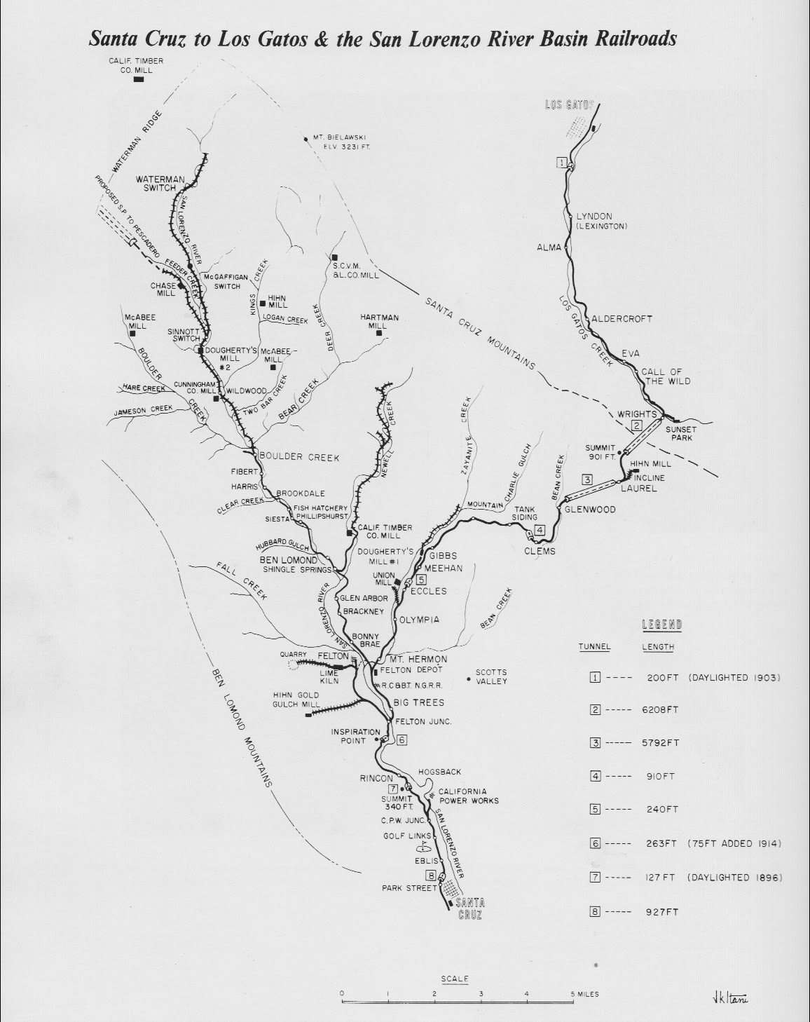 The narrow gauge railroad opened in 1880 from Los Gatos, along the Los Gatos Creek, to Wright’s Station about a mile east of here. From Wright’s Station it went through an over-one-mile long tunnel to Laurel, then through other tunnels to Scotts Valley and Santa Cruz.
At 5:12 a.m. on April 18, 1906 an ominous rumbling announced the most disastrous earthquake in California history. Roads were blocked by landslides, bridges were broken, houses and hotels were shaken to the ground, and the railroad was destroyed.
Ryan Water Company
This is a work in progress. Pieces of history will be added as they are uncovered.
A few bits and pieces are being collected below.
It seems that some misunderstandings existed, resulting in this 1927 Dispute.
This is approximately where we believe the Pipeline existed. Some remnants of the 2″ cast iron pipe can be seen around this area
The source of the water was one or more springs, somewhere along this path.
The following is a transcription of a story written by Bruce Franks about his remembrances of Harry Ryan in xx. I met Bruce shortly after moving to Patchen in 1969. He showed me the best way to shear Monterey Pines when I didn’t know a Monterey Pine from a Doug Fir, and I enjoyed his stories until he passed away some years later.
MOUNTAIN SPRINGS – CALL OF THE WILD
Mountain Springs on the Old Santa Cruz Highway, about a mile above Holy City, was started by Harry Ryan, I believe. It was not a large subdivision and Mr. Ryan had a saw mill right in the middle about where Fritz Knipe’s house is now. Sometime later, Mr. Ryan moved his saw mill to some property he owned on the other side of the highway. A Mr. Frudenthal moved into the Mountain springs area and built some beautiful log homes. Mr. Ryan moved across the road where he built a new saw mill.
He had also started a subdivision there naming it “Call of the wild” after the Jack London book. Jack London was a hero to Harry Ryan. Before coming to the Santa Cruz mountains, Mr. Ryan was a soap box orator for the I. W. W. Movement (International Workers of the World). Mr. London was also an I. W. W. leader and it is said they spoke together many times. So Mr. Ryan named his ranch and subdivision “Call of the Wild.” There was even a Jack London cabin at nearby Chateau Boussy, a local resort, but my father said that while Harry Ryan probably knew Jack London, the closest he ever got to the Santa Cruz mountains was First and Santa Clara Streets in San Jose.
Ryan was a strange man. His wife was a friend of my mother and father, so we would go and visit them every so often. Mr. Ryan was quite deaf and he talked very loud. I can still see him walking from the store at Holy City with a sack on his shoulder. I never knew him to drive.
Just before we moved to the ranch full time, my folks had given me a dog. They had gotten him from the Santa Cruz Pound and I named him Buck. Well, Buck got along well on the ranch, but when we moved back to 42 Broadway, he did not take to city life. He bit a girl from down the street, so Buck had to go. We gave him to Mr. Ryan who had a lot of dogs and one more would not make much difference. I missed Buck and the carefree days of the ranch. We went to see him but he got taken up with his new home and soon forgot me.
The Call of the wild tract was at the bottom of the Ryan property right next to the San Jose Water works water shed property. There is an old road that goes through the land down to the county road alongside the Los Gatos Creek. There used to be a sign on the rail road for a train stop.
Call of the wild had water troubles as did most of the mountain communities. Mr. Ryan had water rights up across the Old Santa Cruz Highway below Mt. Charlie Road, but after the development of Melody Woods in the late 40s the rights were being, challenged. Harry had passed away and Mrs. Ryan went to Shelly Cothran for help,
Now, Shelly had been fighting the San Jose Water Works most of his life, and while he had never passed the bar, he knew the law. He had a photographic mind with an excellent memory to match it. He soon had Mrs. Ryan’s water rights straightened out. He then asked Bill Strang and I if we would put the system in shape, which we did, cleaning tanks and springs and fixing broken pipes. This was really my first venture into the water business. Bill was a good friend. We did a lot of projects together.
I met Bill in a funny way. When I had entered the Masonic Lodge, my father had given me an Art-Carved Masonic ring. I had only seen two others like it. I was issuing Mrs. Strang ~burning permit when she remarked her husband had a ring like mine. This started a long friendship. Later Bill and I, along with Rath Kidwell, started a sawmill on the Cothran property –but that’s another story! Mrs. Ryan sold her property and there are some quite large, nice homes there now, all with their own wells, I believe.
The Call of the Wild story would not be complete without mention of the Gillette Subdivision. This property is just north of the old Ryan land. Mr. Gillette had tried to develop it for a long time but the Lexington Hills Association, along with the County Health Department had always stopped it — lack of water, wrong drainage, and so forth. Then sometime in 1980 it was passed and several large houses were built. In the 1989.. -earthquake they lost their water supply (if they ever had one) and the FEMA people built them a water line hooking them to the Mountain Mutual Supply at Holy City, so now they are in “Fat city.
“Well, that’s Mountain springs, Call of the Wild and Gillette. The old and the new and water something the Santa Cruz mountains will always fight about.
The Ghost Town
In 1949 one of the three buildings that remained of the original town of Patchen was torn down by Paul Von Ahnen who used its hand-hewn timbers to build his house, across the road from here. The building had been the old stage station (Livery Stable), built in the 1870s.
On Sunday, December 29, 1957 fire destroyed the building which had been erected by Joseph Fowler in 1876 as the post office. The two Sycamore trees next to the barn still bear the scars of that fire. Fowler is said to have kept the office in for the four years prior to that time. The chimney of the old post office stood until 5:04 p.m., October 17, 1989 when the Loma Prieta Earthquake brought it crashing to the ground after more than one hundred years.
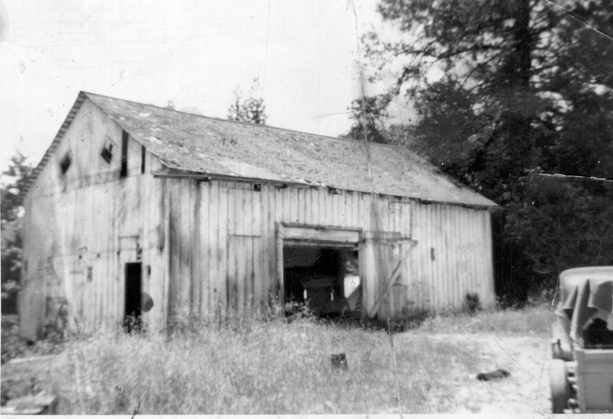
 In the mid 1980s the “Castor Barn”, being the last remaining building, was disassembled to keep it from falling and reassembled on the foundation of the “Laddick House”, which had burned 30 years prior, along with the Post Office building. This restored barn now holds an office, a workshop & electronics lab, and the retail store of the Patchen California Christmas tree business.
The huge concrete located on the property was fed by springs and used as the water supply for the town. It, along with an occasional
ghost sighting, is one of the few remaining parts of the old town.
 The land where the town once stood was purchased, piece by piece, during the late 1960’s and early 1970’s by the current owner and converted to a Christmas Tree Ranch to preserve it from development. You are invited to enjoy the scenery, the mountain air and the history and if you happen to purchase a Christmas Tree while you are here, we thank you for contributing to the preservation of this FAMOUS OLD GHOST TOWN.